UN
5 Keats Grove
£ 133,000
Description
We don't have a Description for this property.
- Bedrooms
- 3
- Bathrooms
- 0
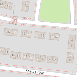


Leaflet © OpenStreetMap contributors
The heatmap indicates the level of crime in the area. The color of the heatmap indicates the crime severity and recency.
Metrics Year-on-Year
- Average area value
- 436,619.00 £Increased by 12.60 %
- Average area rental value
- 1,370.00 £/moIncreased by 52.39 %
- Est rental Yield
- 3.77 %Increased by 35.61 %
- Crime Rate
- 3.00 %Unchanged by 0.00 %
from 387,750.00 £
from 899.00 £/mo
from 2.78 %
from 3.00 %
Nearby Schools
| Name | Type | Ofsted | Distance |
|---|---|---|---|
| Meadowside Community Primary And Nursery School | Academy Converter | 0.45 KM | |
| St Margaret'S Cofe Voluntary Aided Primary School | Voluntary Aided School | Good | 0.46 KM |
| St Stephen'S Catholic Primary School | Voluntary Aided School | Outstanding | 0.49 KM |
| Beamont Collegiate Academy | Academy Sponsor Led | Good | 0.51 KM |
| St Andrew'S Cofe Primary School | Voluntary Aided School | Good | 0.54 KM |
Images
Nearby Streets
| Name | Average Price | Average Sqft | Distance |
|---|---|---|---|
| Keats Grove | £ 235,000 | 0 | 0.00 KM |
| The Coppins | £ 243,333 | 0 | 0.00 KM |
| Sandy Lane | £ 170,000 | 0 | 0.00 KM |
| Clive Avenue | £ 245,000 | 0 | 0.00 KM |
| Tennyson Drive | £ 235,000 | 0 | 0.00 KM |
Nearby Transport
| Name | NLC | TLC | Distance |
|---|---|---|---|
| Warrington Central | 2390 | WAC | 2.33 KM |
| Padgate | 2387 | PDG | 3.23 KM |
| Warrington Bank Quay | 2384 | WBQ | 3.38 KM |
| Newton-Le-Willows | 2257 | NLW | 5.59 KM |
| Warrington West | 6583 | WAW | 6.13 KM |
Nearby Listings
| Address | Price | Type | Score | Distance |
|---|---|---|---|---|
| Byron Court, Warrington | £ 220,000 | BUY | 7 / 10 | 0.12 KM |
| Cossack Avenue | £ 230,000 | BUY | 6 / 10 | 0.17 KM |
| Tennyson Drive, Warrington, Cheshire, WA2 | £ 160,000 | BUY | 6 / 10 | 0.22 KM |
| Tennyson Drive, Warrington, WA2 9BZ | £ 225,000 | BUY | 6 / 10 | 0.22 KM |
| The Coppins, Warrington | £ 250,000 | BUY | 6 / 10 | 0.23 KM |
Nearby Properties
| Address | Price | Distance |
|---|---|---|
| 5 Keats Grove | £ 133,000 | 0.00 KM |
| 20 Keats Grove | £ 85,500 | 0.00 KM |
| 19 Burns Grove | £ 150,000 | 0.07 KM |
| 32 Burns Grove | £ 180,000 | 0.07 KM |
| 26 Burns Grove | £ 115,000 | 0.07 KM |